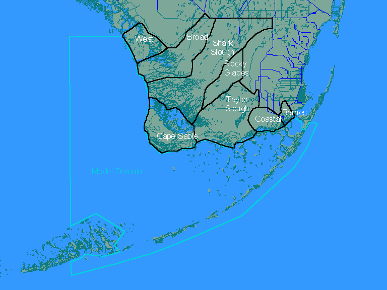
Estimation of Inputs to Florida BaySummary of ResultsJuly 1998Introduction | Tables | Pie Charts | Yearly Inputs to Model Domain | Yearly Inputs to Florida Bay | | Output File | Discussion | This section presents summary tables, graphs, and output data file. For summary purposes, total inputs have been computed for two regions:
The following output tables are attached:
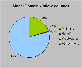
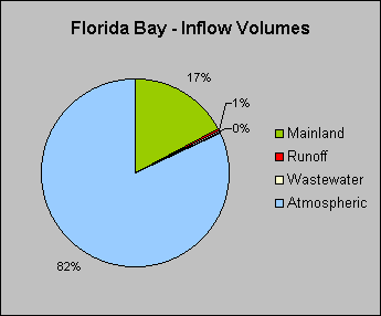
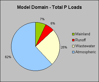
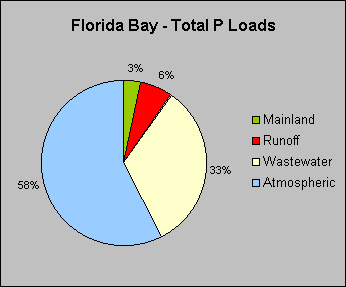
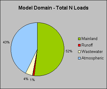
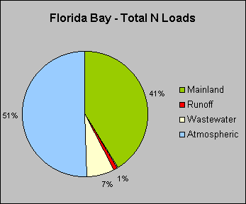
The following pie charts show average percentage contributions of flow, phosphorus and nitrogen from each source category to the entire model domain and to Florida Bay for 1996-1997:
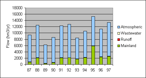
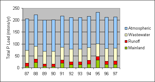
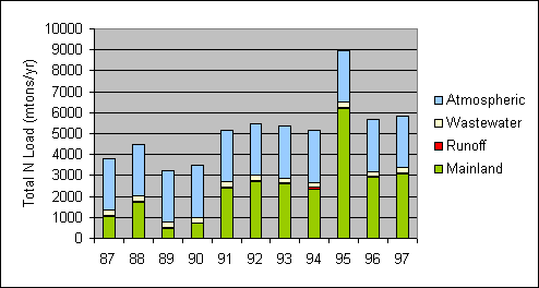
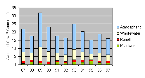
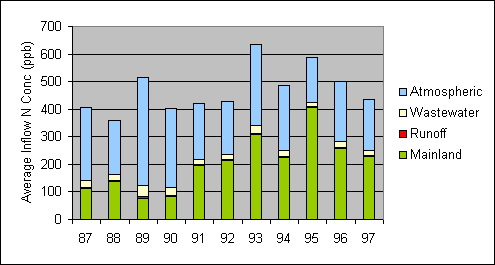
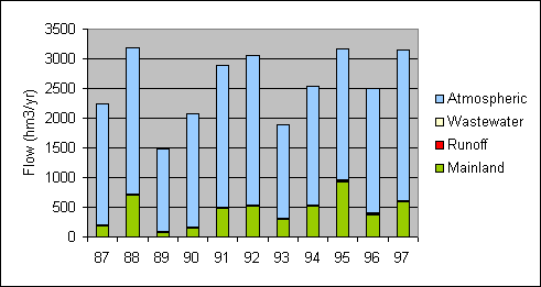
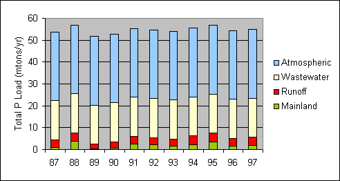
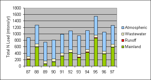
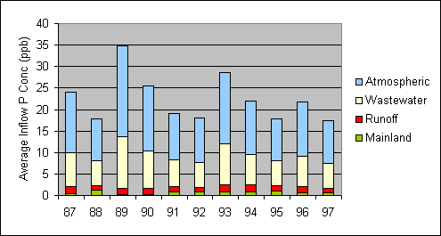
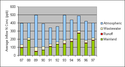
The following charts show yearly variations in flow, phosphorus, and nitrogen inputs to the entire model domain. Average inflow concentrations of phsphorus & nitrogen are computed as the ratio of total load to total inflow volume. Colors reflect percentage load contribution from each source category.
The following charts show yearly variations in flow, phosphorus, and nitrogen inputs to Florida Bay. Average inflow concentrations of phosphorus & nitrogen are computed as the ratio of total load to total inflow volume. Colors reflect percentage load contribution from each source category.
An Excel workbook is contained in the attached compressed file (RESULTS.ZIP, size ~0.8 megabytes) containing monthly results for all input terms is attached. The workbook includes an index of terms, definitions of all water quality variables, atmospheric loading rates, monthly Bay rainfall, and monthly flows & flow-weighted-mean concentrations for each mass-balance term. Results cover the period from October 1986 through December 1997. For some terms, results start in October 1985. Based upon the above results and discussions contained in individual sections of this report, refinements developed under Phase II of this project should focus on the following areas:
Further insights may be gained from sensitivity analyses conducted with the water quality model. http://www.shore.net/~wwwalker/flabay/results.htm Updated: 02/22/00 |